Categories
- Home
- Full Catalog
- Trolling Motors ~ All
- VHF Radios ~ All
- GPS / Fishfinder By Brand
- Coolers & Cooler Bags
- Communications ~All
- Marine Electronics & Instruments ~ All
- Marine Parts & Accessories
- Marine Safety
- Fishing Gear
- Outdoors
- Camping Gear
- Performance Apparel
- Paddle Sports
- Water Sports
- LiFEo4 Lithium Batteries
- Trailering
- Automotive & RV
- Gift Cards
- Contact
HOT Brands
- Regular price
- $2,299.00
- Sale price
- $2,299.00
- Regular price
-
$0.00
- Regular price
- $6,299.99
- Sale price
- $6,299.99
- Regular price
-
$0.00
- Regular price
- $1,999.99
- Sale price
- $1,999.99
- Regular price
-
$0.00
Product sidebar
Product sidebar
Categories
- Home
- Full Catalog
- Trolling Motors ~ All
- VHF Radios ~ All
- GPS / Fishfinder By Brand
- Coolers & Cooler Bags
- Communications ~All
- Marine Electronics & Instruments ~ All
- Marine Parts & Accessories
- Marine Safety
- Fishing Gear
- Outdoors
- Camping Gear
- Performance Apparel
- Paddle Sports
- Water Sports
- LiFEo4 Lithium Batteries
- Trailering
- Automotive & RV
- Gift Cards
- Contact
HOT Brands
- Regular price
- $2,299.00
- Sale price
- $2,299.00
- Regular price
-
$0.00
- Regular price
- $6,299.99
- Sale price
- $6,299.99
- Regular price
-
$0.00
- Regular price
- $1,999.99
- Sale price
- $1,999.99
- Regular price
-
$0.00


Furuno TZT16X 16" Multi-Touch Multi-Function Display [TZT16X]
- Regular price
- $6,195.00
- Sale price
- $6,195.00
- Regular price
-
$0.00
Couldn't load pickup availability
- Brand: Furuno
- Type: GPS - Fishfinder Combos
- Availability: In Stock
Share
TZT16X 16" Multi-Touch Multi-Function Display
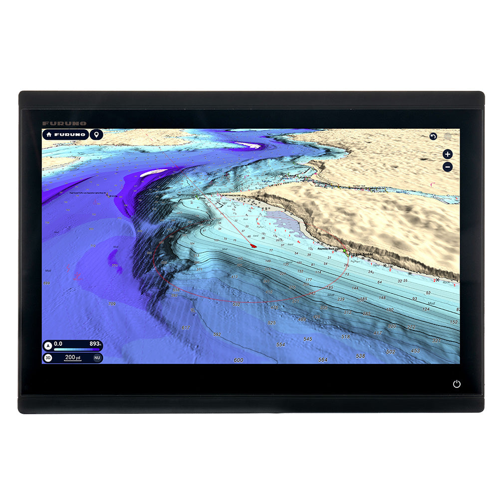
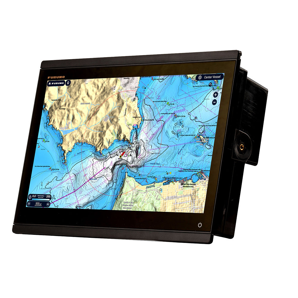
The 16” TZT16X features a super-wide all-glass display with exceptional clarity and brightness. The all-glass design allows these powerful MFDs to be mounted side-by-side for a seamless and stylish all-glass appearance to enhance both the functionality and sophistication of the helm.
The TZT16X incorporates a powerful internal 1kW dual channel TruEcho CHIRP™ Fish Finder* designed to operate across a wide range of frequencies. For those who want to go even deeper, the 2kW/3kW DFF3-UHD TruEcho CHIRP™ Network Fish Finder delivers the ability to penetrate the deepest waters to find a catch. Also, with the BT-5 Booster Box, users can boost that output power up to 5 or 10 kW to take advantage of high-power transducer options that will unveil the deepest waters like users never experienced before.
Features:
- 16 in. all glass display
- TZ MAPS for highly detailed navigation and fishing charts
- Purchase and update charts directly from MFD with an internet connection
- Powerful hexacore processor for rapid response
- Video converter kits stream compatible sonar video data directly to TZtouchXL MFD
- Furuno’s exclusive Fish-It, Drift-It, & Follow-It features save time and fuel and increase fish catch
- Built-in Dual Channel 1kW TruEcho CHIRP™ & CW Fish Finder
- Built-in 235kHz or 455kHz CHIRP Side-Scan
Built-In CHIRP Side-Scan
Furuno’s CHIRP Side-Scan for NavNet TZT16X scans both port and starboard, illuminating the shape of the bottom structure in high definition. CHIRP Side-Scan 6 reveals the shape of fish targets and fish-hoarding structure on each side of the vessel. CHIRP from 235kHz or 445kHz center frequencies with thru-hull, paired, or transom mount transducer options.
TZ MAPS
One of the most exciting TZtouchXL features is a chart offering called TZ MAPS. Not only are these some of the most detailed charts in the industry, but TZ MAPS users are in complete control of the chart content they want to download, such as raster or vector charts, satellite photos, and bathymetric data. Custom user objects can be shared with other registered TZ MAPS users through TimeZero's moderated service. Since custom objects reside on their chart layer on the TZtouchXL MFD, they can easily be displayed or hidden as desired. Additionally, for the first time, customers can purchase and update charts directly on their TZtouchXL MFD!
BathyVision
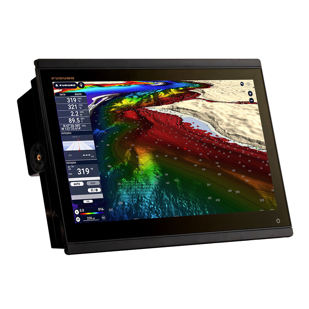
One of the most groundbreaking aspects of TZ MAPS is called BathyVision, providing amazingly detailed bathymetric data that can be configured to an incredible resolution of a mere 3 inches between contours! That's 3 times better than any other bathymetric chart currently on the market. BathyVision data, along with custom depth shading, can easily be overlaid on TZ MAPS navigation charts to create the ultimate "Fishing Charts"!
AI Routing
TZ MAPS unlocks the ability to utilize the powerful AI Routing function that intelligently plans out routes, taking into consideration the boat's draft and navigational obstacles. AI Routing takes traditional auto-routing to another level by automatically creating suggested routes based on varying navigational conditions.
Risk Visualizer & AI Avoidance Route
When connected to an NXT radar, two powerful safety features are unlocked: the Risk Visualizer and the AI Avoidance Route tool. Risk Visualizer provides a 360° visual representation of the potential collision risks of approaching objects around the vessel. Dynamic icons are automatically created for targets with the highest probability of collision, ensuring the captain has the necessary information to maintain safe distances when passing. The AI Avoidance Route function processes all available information provided to dynamically provide a safe route around those hazards, which can be sent to a Furuno NavPilot autopilot with a single tap.
Enhanced User Interface for Ease of Use & Customizability
In addition to offering all the great features that make NavNet super simple to operate, NavNet TZtouchXL MFDs also deliver BIG power and versatility! Users can now configure their MFD in many ways, thanks to an increased number of Page Builder configurations from four (4) to ten (10) custom combinations. Additionally, users can now custom-build a 6-way screen split of various components and sensors.
Match all those great screen layout options with enhanced Edge-Swipe feature access for the smoothest, easiest, and very best user experience Furuno has ever delivered! This is all driven by the most system memory and the highest level of processing power Furuno has ever integrated into a NavNet MFD.
Specifications:
Display Unit:
- Type: Color TFT multi-touch IPS LCD
- Screen Size: 15.6" Wide
- Screen Resolution: FHD 1920 x 1080
- Screen Brightness: 900 cd/m2 (typical)
- Display Colors: 16,770,000 colors (Chart Plotter), 64 colors (Radar/Fish Finder)
- Language: Bulgarian, Chinese, Danish, English (USA/UK), Finnish, French, German, Greek, Italian, Japanese, Norwegian, Portuguese, Russian, Spanish, Swedish, Turkish, Polish
GPS/WAAS:
- Receiver Type: GPS: 72 channels, SBAS: 1 channel (C/A mode, WAAS)
- Receiving Frequency: L1 (1575.42 MHz)
- Time to First Fix: 100 s (cold start)
- Accuracy: 10 m (GPS), 7 m (MSAS), 3 m (WAAS)
- Position Update Interval: 100 ms or 10 Hz
Chartplotter:
- Cartography: TZ MAPS, MM3 Vector, and CMOR capable (U.S. only)
- Memory Capacity: 30,000 user points, 100,000 points for ship's tracks, 200 planned routes (500 points per route)
- Alarms: Anchor Watch, XTE, Depth*, Speed, Sea Surface Temperature*, Trip Distance, Fuel Gauge* (*external data required)
Radar:
- Display Modes: Head-up, North-up* *Heading input required.
- Echo Trails: Interval: 15 s, 30 s, 1 min, 3 mins, 6 mins, 15 mins, 30 mins, and continuous (Heading input required)
- Target Tracking: 100 ARPA Targets (Radar dependent) with fully automatic target acquisition (Heading input required)
- Radar Alarms: Guard Zone, CPA/TCPA, Video, Azimuth, Heading Line
Fishfinder:
- Transmit Frequency*: CW: 50/200 kHz, CHIRP: 40 kHz to 240 kHz (Low, Medium, and High)
- Transducer: 300/600 W or 1 kW* *Matching box MB1100 required for some transducers
- Display Range: 2 to 1,200 m; shift 0 to 1,200 m (1,200-2,400m / 4,000-8,000ft)
- Extension Mode: ACCU-FISH™, A-Scope, Auto (Fishing/Cruising), Bottom Discrimination, TruEcho CHIRP™ (with compatible transducer)
- Picture Advance: 8 steps: x4, x2, x1, 1/2, 1/4, 1/8, 1/16, stop
- Fish Finder Alarms: Fish School, Fish School for the bottom lock
Side-Scan:
- Transmit Frequency*: CHIRP: 220-240KHz/445-465KHz
- Transducer: 225kHz: 225T-PR904, 225T-SS904. 225T-TM904 / 455kHz: 455T-PR903, 455T-SS903. 455T-TM903
- Display Range: 750 feet to each side
- Display Colors: Green, Blue, Amber, White
- Display Screen Sizes: Full Screen, 1/2 Screen, 1/4 Screen, 1/6 Screen Full Screen, 1/2 Screen, 1/4 Screen, 1/6 Screen
- Direct Connect to MFD: Direct connect to TZ10X, TZT13X, TZT16X only; may be networked with TZT22X/TZT24X
Interface:
- NMEA200: 1 Port
- Input: 065280, 126992/993/996, 127237/245/250/251/257/488/489/505, 128259/267, 129025/026/029/330/038/039/040/041/291/538/540, 129793/794/798/801/802/808/809/810, 130306/310/311/312/313/314/316/576/577/578, 130817/818/820/822/823/826/827/828/880
- Output: 126992/993/996, 127250/251/257/258, 128259/267/275, 129025/026/029/033/283/284/285, 130306/310/311/312/313/314/316
- NMEA0183: 1 Serial Output Port
- Output: AAM, APB, BOD, DBT, DPT, GGA, GLL, GNS, GSA, GSV, RMB, RMC, RTE, TTM, VDM, VTG, WPL, XTE, ZDA
- LAN: 1 Port (1000 BASE-T)
- USB: 1 Port (USB 3.0) for touch monitor and control unit: 1 Port USB touch output for HDMI device
- Video I/O: Input: 1 port (NTSC/PAL) and 1 port HDMI 1920 x 1080p or less (progressive only); Output: 1 port (HDMI 1080p)
- AUX I/O: 2 Ports (Event Switch and External Power Switch)
- SD Card Slot: 1 Slot (Micro SDXC, rear)
- Wireless LAN: IEEE802.11b/g/n, Transmit frequency: 2.412 to 2,462 GHz, 11dBm max
- Transducer Connection: 1 Port 12 pin for CHIRP/CW, 1 Port 12 pin for Side-Scan
Environment:
- Temperature (IEC60945)-15°C to +55° C
- Relative Humidity: 93% or less at +40° C
- Waterproofing: IP56
Power:
- 12-24 VDC
Specifications:
- Screen Size: 16"
- Touchscreen: Yes
- Box Dimensions: 13"H x 16"W x 19"L WT: 17.3 lbs
Brochure (pdf)
